As you realized, the problem with the Microdisplacement feature is that it doesn't generate a real displaced mesh which has dimensions. But when you are using a greyscale height map and use it on the plane, there is a way to guess or more or less accurate calculate the height.
The greyscale values usually range from black (0) to white (1). In my example, I have a heightmap of a mountain where the darkest part is 0.0 and the brightest (highest) part is around 0.3 (it's not going all the way up to 1).
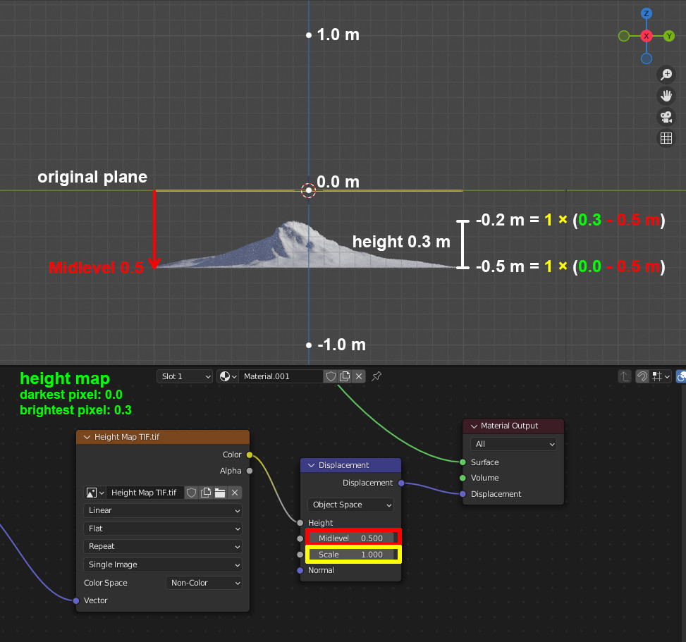
If you now have a plane with a scale of 1/1/1 and plug the height map into a Displacement node and leave it at the default values (Midlevel 0.500 and Scale 1.000), the lowest part will be at -0.5 meters (below the original plane) and the heighest part will be at -0.2 meters, which makes a height of 0.3 meters.
So, to sum it up: at a scale of 1, the height of the terrain will be the height of the brightest pixel, and the "ground level" will be the original plane minus the midlevel value. If the darkest pixel in your height map is brighter than 0.0, it will be that much above ground level.
This is an example with the Displacement node's default settings, the Midlevel value is at 0.5 and the Scale is at 1:

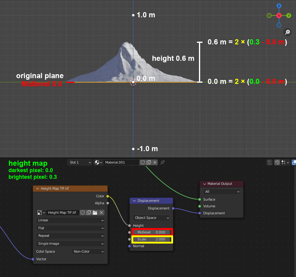
And for comparison, the Midlevel set to 0.0 and the Scale factor set to 2, doubling the height of the terrain:


