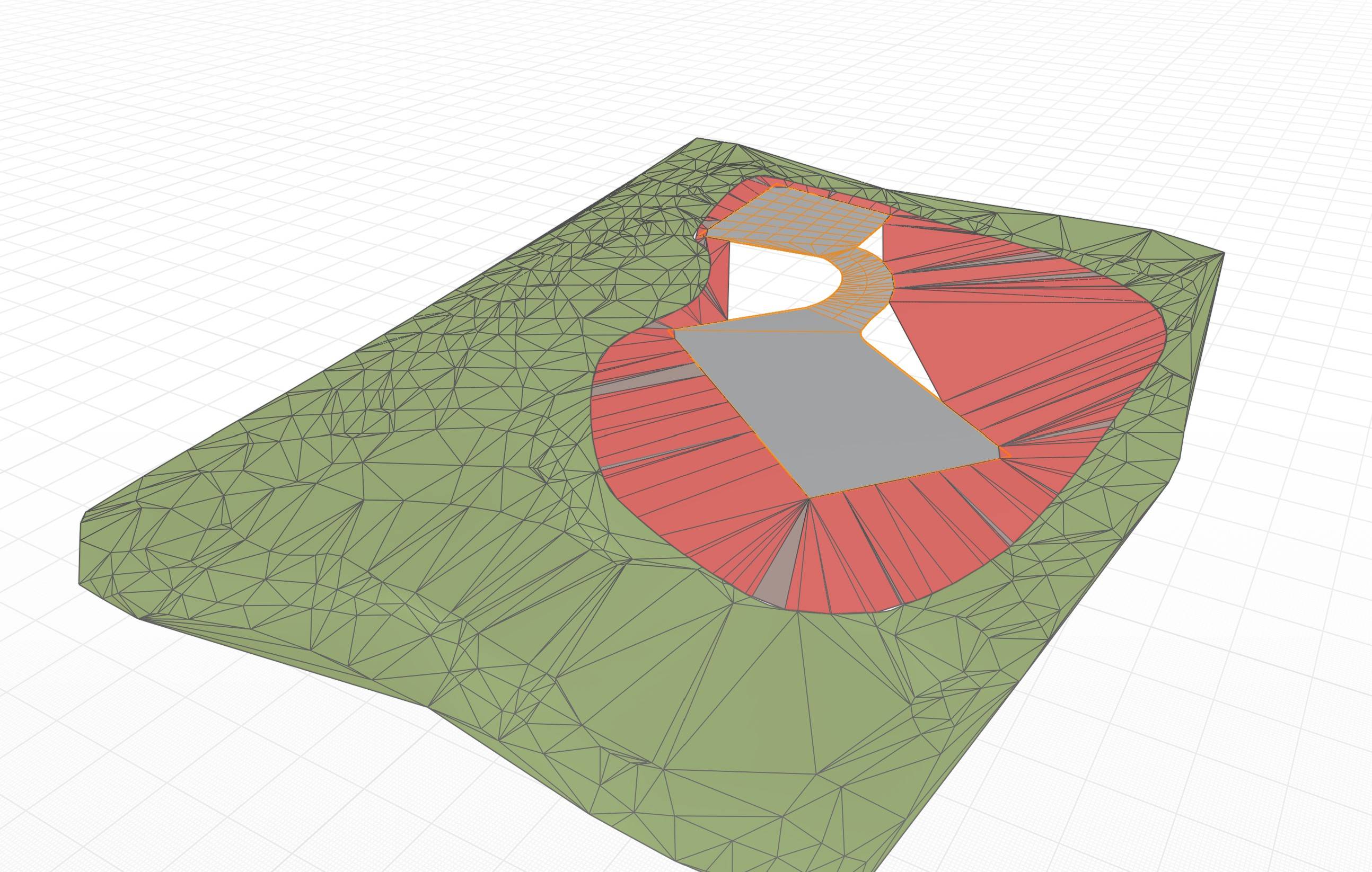
I'm trying to create a procedural way to connect paved areas of varying elevations and slopes to a terrain model. There are excellent plugins such as Archipak to do this with flat building slabs and roadways but not for irregular paved areas with slope like parking areas and driveways. Here's what I have so far. There are issues with normals flipping and gaps where there are tight curves.

$\begingroup$
$\endgroup$
1
-
$\begingroup$ nice...better would be if u provide a blend file so we don't have to rebuild everything. thx. $\endgroup$– ChrisCommented Sep 16, 2022 at 8:23
Add a comment
|
1 Answer
$\begingroup$
$\endgroup$
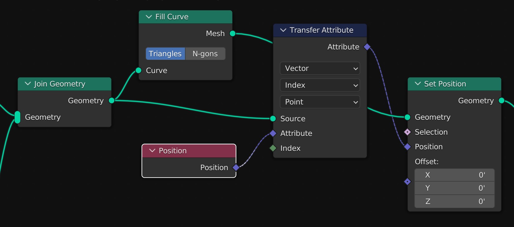
The solution is really simple. Join the 2 curves, fill them with FillCurve, then transfer the Z values with TransferAttribute.


