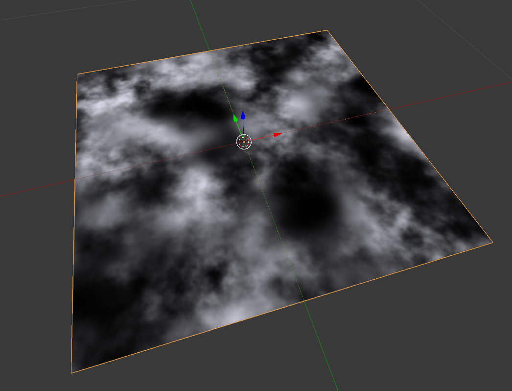
Trying to do some golf course layouts in 2.73a. Would like to use topo elevation info. Currently have grayscale .jpg of site - top view. How do I get this into Blender as a "lumpy" plane?
-
$\begingroup$ @NeverGiveln is the topo info on the grayscale image(grayscale->height) ? $\endgroup$– ChebhouCommented Mar 21, 2015 at 14:38
-
$\begingroup$ Yes, the grayscale equals elevations, but I'll have to eyeball the heights. I tried working with DEMs, but that didn't work out. Thankfully it doesn't have to be exact. $\endgroup$– NeverGiveUpCommented Mar 21, 2015 at 15:23
2 Answers
Import an image with the Images as planes add-on, to create a plane with the same proportions as the image you want to use on the landscape.
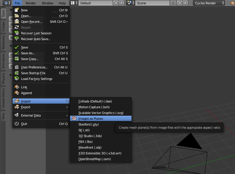
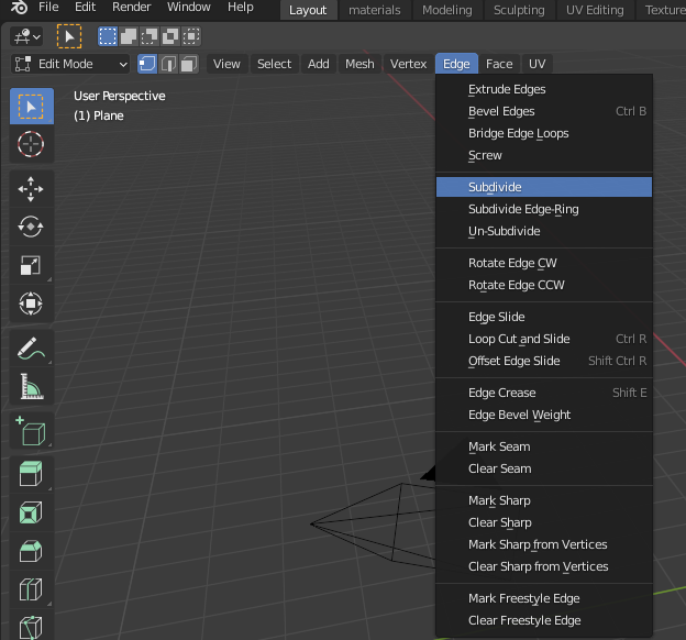
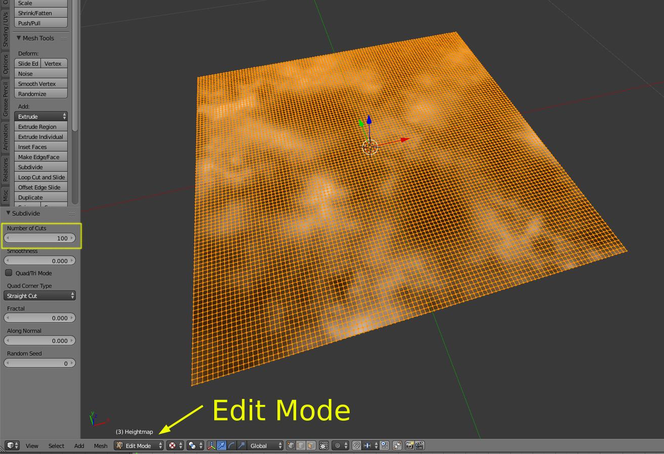
Enter edit mode Tab, and subdivide your mesh.
(On version 2.7 press W)
Start with 100 subdivisions.
The number of subdivisions will be directly proportional with the level of detail for your displacement.
Exit Edit mode (Tab)
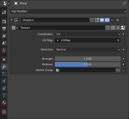
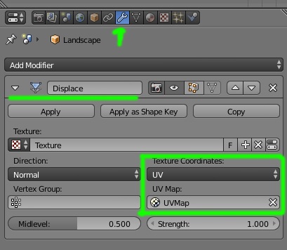
Add a displace modifier with the following settings: Direction Normal, Texture Coordinates UV (The UV map has been generated automatically when you use the import images as planes)
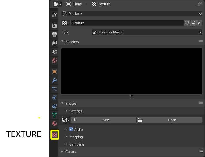
Assign the texture to be used with the displacement modifier.
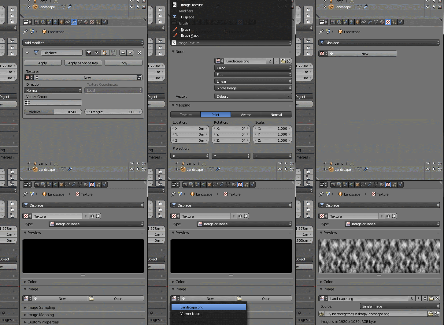
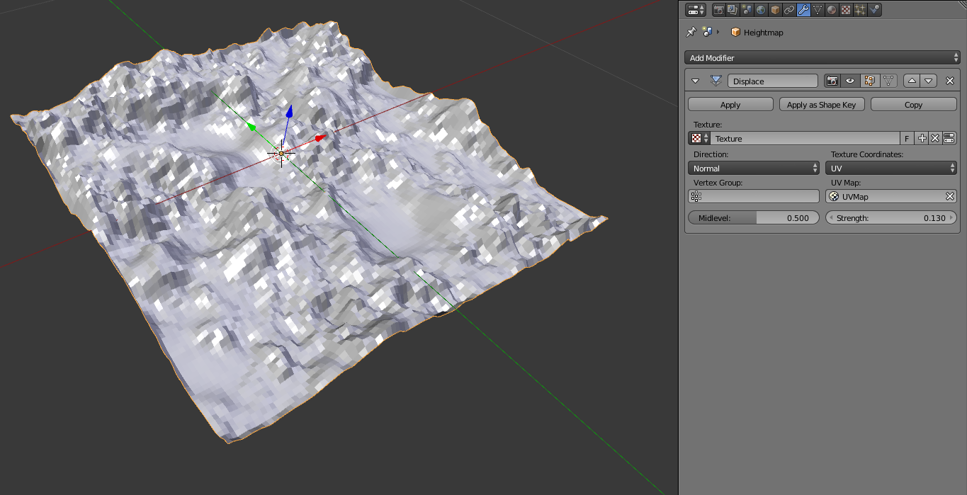
Your plane will deform using the texture.
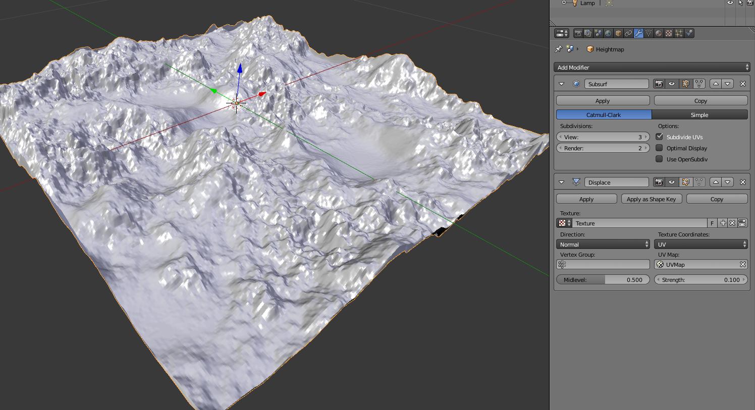
At this point you can subdivide further or add a subdivision surface modifier for better detail. To control the height on the deformation play with the Strength value on the displace modifier.
But be very careful with the subdivision modifier. It is quite easy to create a very large number of subdivisions, and that might push your system's performance to the edge or make it crash. Read:
You need to use a displacement modifier.
To set this up, add a sub-surf modifier and set it to simple.
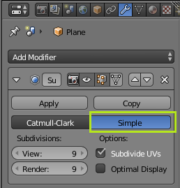 This will subdivide the plane. You will need to set the division to create a number of vertices equal to the resolution of your map. This works in binary, so if you map is 29 x 29 you will wan't to set it to 9.
Add the displacement modifier, and add your texture to it. You will now need to calibrate the strength. You will need to apply any scale Ctrl-A the default strength of one sets it to about 2/3 of a meter tall. Find the total height of the tallest point on you map, and take the height h and times it by 2/3, (h)(2/3).
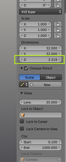
You can double check that the height is correct by hitting N and look at the dimensions in the property panel. This will allow you to fine tweak the results.
